
Most of map/plan/drawing collections listed below are in hard copy format and may be accessed by appointment in our research room. For a full listing, do a search of our online catalogue or request listings by email to archivist@corkcity.ie
Local Government and Ordnance Survey Maps
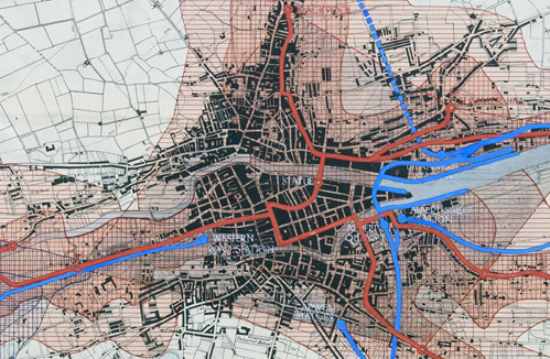
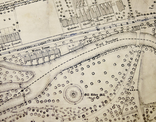
City Engineer OS Maps (1869) 1893 - 1934 (1951)
City of Cork Civic Survey maps, 1924-1925
Building Control, Cork City Council, maps, plans, drawings (1840s) 1900s.
Cork Wide Streets Commissioners, maps, plans, drawings, c1820s-1840s
Ordnance Survey Maps of Cork East and West Riding, 1841
Architectural or Engineering Plans and Drawings
Chillingworth and Levie architectural drawings (1899) 1911 - 1972
City Architects Department drawings, mainly housing, 1970s-1990s
City of Cork Steampacket Co. Plans, Drawings, and Photographs, 1888 - 1951 (1853, 1855)
Cork City Gaol, Sunday's Well, Cork, plan drawing, 1926/1931
Cork City Hall architectural drawings c1920s-1970s
Cork County Hall architectural drawings c1950s, 1960s
Cork District Lunatic Asylum South Elevation Drawing, 1847
Electricity Supply Board, Customer and Connection Drawings Volumes, Cork City. c1900-1950
English Market Architectural Drawing, 1956
Former Lee Boot Factory, Washington Street, Cork, Historic Building Record and Drawings, 2022
Institution of Engineers of Ireland Research Collection (1851) 1952, c.1975 – c.1985
New Cork Public Library, Grand Parade, 1927
Samuel F. Hynes collection - churches, 1890s - 1922
Youghal Gaol Drawings and Specifications- Pain Brothers and others, 1825-1831

Estate Maps
Bauravilla (near Skibbereen), map, 1854
Bishop's Palace Demense, St Finbarre's Cathedral, Maps, 1794, 1797
Castle Hyde Estate, Rental and Particulars of Sale, 1851
Earl of Egmont Estate, Kanturk maps 1737, 1756, 1824
Frank Feeney Maps Collection, 1830-1836 (mid 1900s, 1990)
Longfield Castlemary Estate survey, 1865
Templebodan, near Midleton, 1785
Viscount Midleton estate report, 1850
Waterview Estate Passage West, 1874
Other Maps/Drawings
Paddy O'Keeffe Map Collection, copies, mainly West Cork, 1500s-1960s
Cork City OS Map inscribed by Robert Walker, c1860-1910 [1595-1915]
Daniel MacCarthy Glas collection, drawings, 1820-1866
South Mall and Grand Parade, Cork. Large watercolour drawing/painting. Mid 1800s
For a full listing, do a search of our online catalogue.